We use cookies to improve your experience and analyze site traffic. By clicking "Accept", you agree to our use of cookies.
Pirita sadam → Naissaare sadam
~ 9.68 nm ~ 1 h 56 m
14
0
Sailing route: from Tallinn to Naissaare
The route from Pirita Harbour (59.470002,24.820001) to Naissaar (59.556304,24.55225) covers 9.68 nautical miles, typically sailed in under 2 hours. Departing Pirita, maintain a careful watch for local traffic, especially small craft and ferries near the harbour entrance. The initial waypoints (to 59.470926,24.816731) follow the channel; keep clear of shallow banks east and west of the marked fairway.
After clearing the Pirita approaches, set a WNW course towards Naissaar. The Gulf of Finland here is busy with commercial shipping lanes running NE-SW; cross these at a right angle and maintain a sharp lookout for fast-moving vessels, especially tankers and ferries bound for Tallinn.
Prevalent winds are SW-W in summer, often moderate but can freshen quickly. Seas can become choppy with wind against current. Approaching Naissaar’s SE coast (from 59.553651,24.561637 onwards), beware of underwater rocks and shoals extending from the island—keep to the recommended approach line and consult up-to-date charts. Anchorage is best on the island’s SE side, sheltered from prevailing winds.
Total route length: 9.68 nm
Distances between key points:
- Pirita sadam → Naissaare sadam: 9.68 nm (≈ 1h 56m) GPX
Estimated duration at 5 knots: 1h 56m
Round trip (same route): 19.36 nm •
~3h 52m
Also on this route


Yachting school

Yacht store
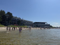
Beach

This route was added by user Nikolay Pavlovskiy
11 September 2025
Skippers Reviews
0
Based on 0 Reviews
0%
0%
0%
0%
0%
Export a clean route video for social media.
Marinas on the Route

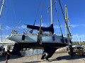
Pirita sadam Start
Tallinn